

Transforming Urban Planning with Advanced Land Development Software Solutions
The Role of Land Development Software in Modern Urban Planning
In today’s rapidly evolving world, urban planning plays a crucial role in shaping sustainable and efficient cities. With the increasing need for smart development solutions, land development software has become an indispensable tool for urban planners, architects, and developers.
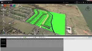
Land development software offers a wide range of functionalities that streamline the planning and design process. From site analysis to conceptual design and project management, these tools provide comprehensive support throughout the entire development lifecycle.
Key Features of Land Development Software:
- Site Analysis: Utilizing GIS data and mapping tools to assess site characteristics such as topography, soil composition, and environmental constraints.
- Conceptual Design: Creating 2D and 3D models to visualize proposed developments and analyze their impact on the surrounding environment.
- Zoning Compliance: Ensuring that proposed projects comply with local zoning regulations and land use ordinances.
- Infrastructure Planning: Designing transportation networks, utilities, and other essential infrastructure elements to support future developments.
- Environmental Impact Assessment: Evaluating the environmental implications of proposed projects to minimize negative effects on ecosystems and natural resources.
The Benefits of Using Land Development Software:
By leveraging land development software, urban planners can achieve the following benefits:
- Efficiency: Streamlining the planning process and reducing time spent on manual tasks.
- Accuracy: Enhancing data accuracy through advanced mapping and analysis tools.
- Sustainability: Promoting sustainable development practices by optimizing resource utilization and minimizing environmental impact.
- Collaboration: Facilitating collaboration among stakeholders by providing a centralized platform for sharing project information.
In conclusion, land development software plays a pivotal role in modern urban planning by enabling professionals to create smarter, more sustainable cities. As technology continues to advance, these tools will become increasingly essential for shaping the future of our urban environments.
Understanding Land Development Software: Key Features, Benefits, and Integration for Sustainable Urban Planning
- What is land development software and what does it do?
- How can land development software help streamline the urban planning process?
- What are the key features and functionalities of land development software?
- Is land development software compatible with other planning and design tools?
- How does land development software contribute to sustainable and efficient city planning?
What is land development software and what does it do?
Land development software is a specialized tool designed to assist urban planners, architects, and developers in the planning and design of land development projects. This software encompasses a range of features that enable users to analyze site characteristics, create conceptual designs, ensure compliance with zoning regulations, plan infrastructure elements, and assess environmental impacts. By providing a comprehensive suite of functionalities, land development software streamlines the development process, enhances efficiency, promotes sustainability, and facilitates collaboration among stakeholders. Ultimately, this software plays a vital role in shaping sustainable and efficient urban environments by leveraging advanced technology to optimize the planning and design of land development projects.
How can land development software help streamline the urban planning process?
Land development software plays a crucial role in streamlining the urban planning process by providing tools and functionalities that enhance efficiency and accuracy. By utilizing features such as site analysis, conceptual design, zoning compliance checks, infrastructure planning, and environmental impact assessments, urban planners can make informed decisions and visualize proposed developments effectively. This software enables professionals to optimize resource utilization, minimize errors, and collaborate seamlessly with stakeholders, ultimately leading to more sustainable and well-planned urban environments.
What are the key features and functionalities of land development software?
Land development software offers a comprehensive set of key features and functionalities essential for efficient urban planning and development. These tools typically include site analysis capabilities that leverage GIS data for assessing site characteristics, conceptual design modules for creating visual representations of proposed projects, zoning compliance checks to ensure adherence to local regulations, infrastructure planning tools for designing essential utilities and transportation networks, and environmental impact assessment functionalities to evaluate the ecological implications of developments. By integrating these features, land development software empowers planners and developers to make informed decisions, streamline processes, and create sustainable urban environments.
Is land development software compatible with other planning and design tools?
Land development software is designed to be compatible with a variety of planning and design tools commonly used in the industry. Integration capabilities allow users to seamlessly transfer data between different software platforms, ensuring continuity and efficiency in the planning process. By enabling interoperability with other tools, land development software enhances collaboration among stakeholders and promotes a more holistic approach to urban planning and design projects.
How does land development software contribute to sustainable and efficient city planning?
Land development software significantly contributes to sustainable and efficient city planning by providing urban planners with powerful tools to analyze, design, and manage development projects. These software solutions enable planners to conduct in-depth site analysis, assess environmental impacts, and optimize resource allocation. By leveraging data-driven insights and advanced modeling capabilities, land development software helps identify opportunities for sustainable growth while minimizing negative effects on the environment. This technology facilitates collaboration among stakeholders, streamlines decision-making processes, and ensures that urban developments align with long-term sustainability goals. Ultimately, land development software plays a crucial role in creating resilient cities that are environmentally conscious, economically viable, and socially inclusive.